Regarding your moor/river comment. How do rivers make vanilla pools worse? You mean where they connect into the side of the river? I'm honestly surprised you guys don't just mod the vanilla pool generation and placement behavior. They're always too sunken and are more like sinkholes. I think they should be placed at least one block higher or the water level of the pool generation algorithm moved up. I'm to the point where when I generate a new world I'll do so in customized mainly so I can turn water pools down to about lava pool levels.
Regarding your moor/river comment. How do rivers make vanilla pools worse? You mean where they connect into the side of the river? I'm honestly surprised you guys don't just mod the vanilla pool generation and placement behavior. They're always too sunken and are more like sinkholes.
Slopes make vanilla pools worse because they end up even further down in the ground. Rivers create that problem with Moor pools because Moors are a fairly high biome and so RTG has to generate a slope down to the river.
We have written an improved version of vanilla pools but the way the game is written it's hard to change the game and requires hacking JVM code. We use our version of pools when we do the decorations but for BoP we are just using their decorations.
Rollback Post to RevisionRollBack
Geographicraft (formerly Climate Control) - Control climate, ocean, and land sizes; stop chunk walls; put modded biomes into Default worlds, and more!
RTG plus - All the beautiful terrain of RTG, plus varied and beautiful trees and forests.
The issues with vanilla pools largely stem from the fact that the game tries to generate them at a random altitude (the lake code will search downwards for solid ground if placed in the air) and the ground is rarely perfectly flat; the only restrictions on their generation are that there must be no water above their water level (within or in the walls of the cavity they generate when underground) and no air below. If they only generated on flat level ground and only at the surface there wouldn't be any issues.
My own mod's Tropical Swamp biome uses a modified version of the vanilla lake code, as well as a separate lake generator which creates 2x2 patches of water, to generate 1 block deep water lakes at the surface and most of them generate as intended; there are a few issues where the ground is more uneven but for the most part they generate level with the surrounding ground, which is very flat (minHeight and maxHeight are both 0 so there is only a slight variation from the base depth noise). I did not modify the water level used, only the code that defines their shape and how many layers deep they are (one layer of water with one layer of air carved out over it, with 1/20 of air blocks over water being lilypads):
This is one of the (few) lakes that didn't generate level with the surface on all sides, undercutting the land on the top left:
Another characteristic of these lakes is that if they generate under a tree they will fill the trunk in (or the supports of a witch hut), thus making it appear as if jungle trees grew in them, similar to swamp trees (which can grow in 1 block deep water); unlike normal world generation I generate trees before lakes (not that this matters much in vanilla due to the overlap between populated regions):
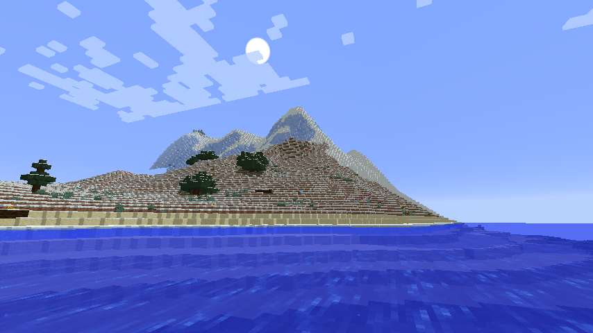
Chapter 62: In Which I Discover Limitations in a Spiraling Outward Strategy, Especially When I Keep Taking River Excursions.
Exploration Limit: X = -912,000
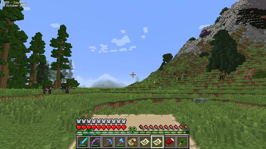
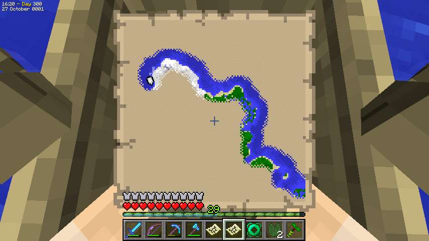
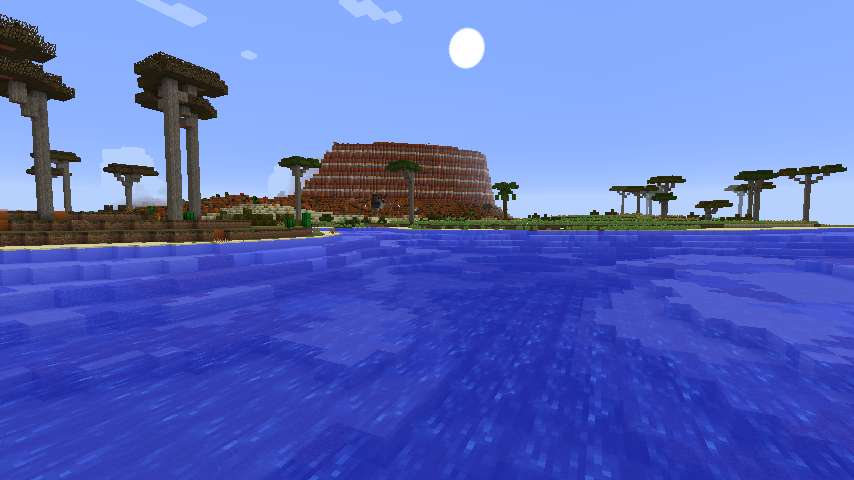
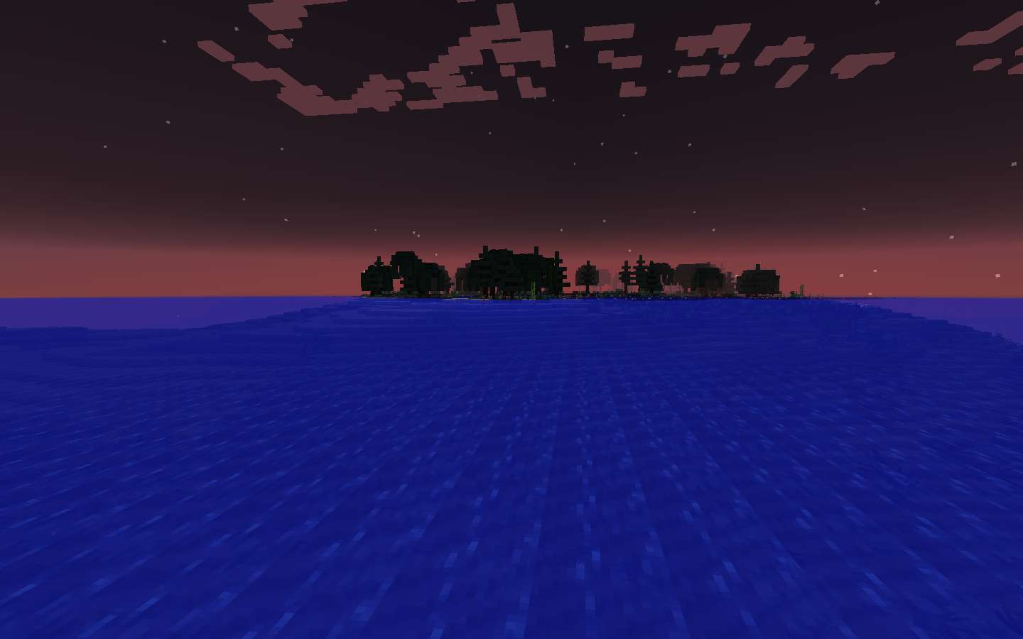
In the morning after the zombies burn off I strike out to the east over the lake, continuing a spiral outward from the base. The Boreal Forest I'd been so interested in turns out to be mostly a crescent bordering the lake, so I'm still looking for a full-fledged Boreal Forest.
After that I pass through some biomes near my base - the Meadow and then the Moor heading east, then north through the Moor and Savanna, then northwest through the Swampland and Wetland. I've shown all these so I'll skip pics.
The Wetland turns out to be south of the Ocean so I guess that's the limit there.
From there I continue northwest into an Orchard where the coast bends to the north.
Continuing into the Ice Plains from last chapter I find a river going north. I don't think riverboating will help with this kind of exploration but I decide to take it anyway for the fun of it. I move quickly north on the Frozen River, then still pretty fast through a Sheild except for one little spot where the river has a gravel sandbar.
I suspect the reason for that is an Extreme Hills I can glimpse through the trees. Then I go north through a Shrubland with the Extreme Hills still visible, then the Extreme Hills blocks my was and the river ends. By now I'm off the map to the north and have to make another.
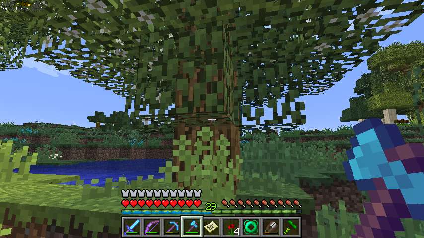
This area is a smallish penisula with a Moor and the Extreme Hills. I spend an evening ensconced on a Harvestcraft tree in the Moor. Continuing counterclockwise around my existing explorations, I turn south.
The Extreme Hills is a milder one except for that one really massive massif. I was resistant with the other RTG members pushed to revise Extreme Hills but I am really happy how it's coming out.
The coast veers to the east and I end up crossing this bay to get back to the Ice Plains. I continue south there.
My attempt to spiral outward is looking pretty ragged.
Further south, I pass through a Sheild, then more Shrubland, then Moor, then Extreme Hills. I'm getting a lot of locally repeated biomes. I'm not sure whether it's biomes getting copied during terrain manipulations or the random number generator not being quite right. It's not a bad effect, actually, because it makes terrain vary from place to place, although I do worry it reflects some programming flaws.
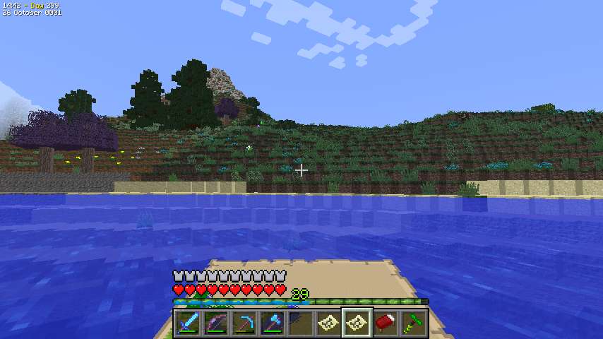
After all those rugged biomes I finally come to an open Plains, with a river, which I boat on in spite of the fact that river exploration obviously isn't working with this spiral out system.
It's a short river, though, and I quickly reach the sea and turn east again. Next is a Bog which I explore by boat, and then I have to turn north to pick up a spot I missed.
From this area I spot a Roofed Forest, but fortunately a smallish one so I should be able to map it by going around. On this circuit I go north of it.
Back on the Moor I spot what I think is an Extreme Hills in the distance, although when I get closer it turns out to be Chapparal. This is on the next map to the east, so I make another map. There's a village there too, which is good since I need to sleep soon, but even from here it looks to be pretty messed up. Besides the problems with the mountain, the Moor pools have intruded into the village and wrecked several of the houses. I sleep in an intact outlying farmhouse.
And it's even worse than I thought. It's been a long time since I saw a village this messed up. The Creeper outline is the resident of the Blacksmith's, of all places. After I off it, I collect two obsidian from the lava pool for Waystones.
Continuing counterclockwise, I go north through the Chaparral, then northwest through the Savanna and Wetland, finally reaching the north coast here. I take to the boat. I boat over to that strip I missed, which is Orchard, exploring that, and finding a village where I get two more obsidian. Then it's back to the boat and I loop north around the penisula on the map to the north.
After a snooze on some Extreme Hills trees, I boat across the bay again to land on the Ice Plains again.
South of the Ice Plains is yet another Moor. I deviate from my outward spiral and wriggle back and forth as I go down since the remaining land is a bit wider than my mapping path. Twice my Rod of the skies lets me hop out of a sinkhole I fall into.
This area is a penisula, and terminates with this smallish hill reaching into the sea.
Now I turn east again and boat across the bay south of the bog.
On the other side is yet another Extreme Hills with yet another cool formation. This is against the sea and I climb it partly to fill out the map and partly to see how high it is (172). Then I turn to the northeast along my previous path, reaching the Roofed Forest I saw on the last go-round.
I skirt it to the south this time and hop up to an outlying tree for the night. In the morning I have an annoyance because when I chop my bed it falls off the tree to - well I can't see where. I have wool so I can just make another, though.
I had thought I'd be able to map the Roofed Forest from the exterior but it turns out there are still a few pixels left. So I try Keybounce's suggestion and go a little bit in on top of the trees - *very* cautiously. I get my mapping done, and then hop off the trees into the adjacent Bog to the east, to continue exploring.
I boat across the Bog, and then come to a Moor. I've reached the next map to the east, and I continue eastward, preparing to wrap north around a small strip I'd explored last time.
But I soon reach the coast, and now I realize that, at the least, slavish adherence to my spiral-outward plan would create some trouble. There's an area of land to the south that would be "cut off" if I kept spiraling, so I think I'm going to change exploration strategies now.
Next Chapter: A Change of plan - and then another change of plan!
So I turn back and head west again, just south of existing explorations.
I go back through the Moor, and then reach this Cold Taiga I'd seen from afar.
I follow the river to the coast, which is heading south. Apparently there's another peninsula here. I turn south, going from the Cold Taiga to an Ice Plains. Soon I have to make another map.
I go through a section of Tundra, then more Ice Plains.
This is indeed a (smallish) peninsula, and the Ice Plains continue all the way to the end. I go around the end and then head back. As with the Ice Plain/Moor section on the west side of the continent, the remaining land is wider than my map strip and I have to go back and forth to fill it out.
Night is coming and I sleep atop some of the Cold Taiga trees.
In the morning I finish the peninsula. I then boat east to pick up a little more land at the southeastern tip. As it turns out, the little bit left I can get from the boat. I then continue by boat up the eastern shore past areas I've explored or at least come close enough that I can finish from the boat.
Soon I come to something I initially expect is a strait but turns out to be a deep narrow bay.
I land and look around, but I start to feel frustrated at not having any idea how much I have left to do. I've explored the entire western end of this continent, but I have no idea how big the eastern end is. Struggling through those Extreme Hills isn't looking too convenient either. So I decide spiraling out just doesn't work, and to go to my old standby of naval circumnavigation first to see what I'm up against.
So, back to the boat, south out of the bay, and then east along the shore.
Soon I reach the place where I landed on the continent, but I continue along the shore, which turns from east to northeast here.
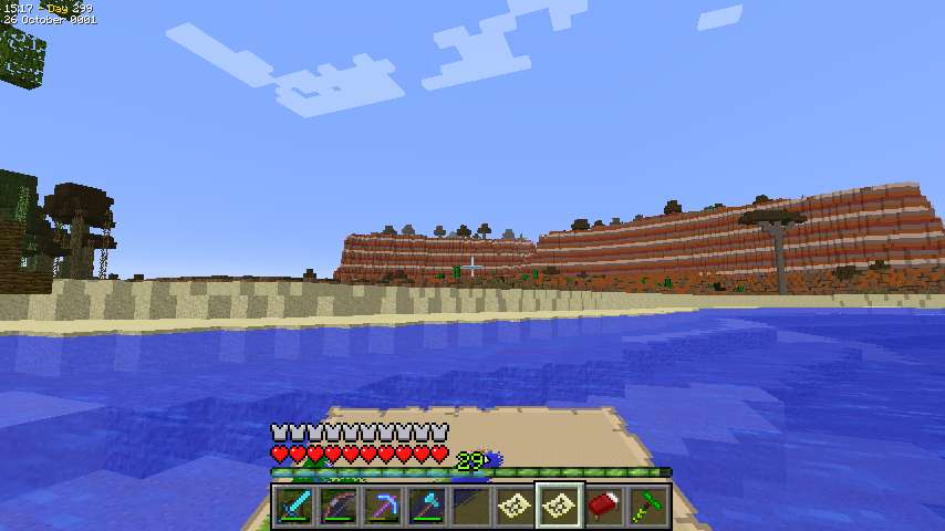
I pass this interesting-looking Mesa, and then another Extreme Hills. Then the coast bends back east again, and I reach a Xeric Shrubland.
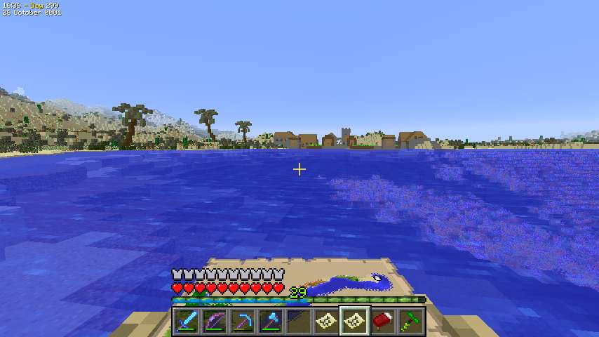
The coast finally turns north, and I spot this port village, conveniently as it's late in the afternoon. I wander around a bit chatting with the villagers and then spend the night there.
Back on the boat, I follow the coast which bends back to the east and goes on to the next map. I can tell it's only one tiny segment but I make a map anyway.
This end of the continent is very swampy.
The coast heads on to the next map, where I also realize there's just a tiny bit of land but I make the map anyway. Then it bends back to the west and I make my third map in a few minutes. It's unfortunate that the tip of the continent was right on a 4-way map intersection.
I head west on the edge of a Bog. I'm feeling kind of in a hurry so i don't detour to map the interior, although I do cut through accidentally once because sometimes it's hard to distinguish the underwater sections of Bog from the Ocean.
The Bog produces one little desert island well offshore.
Then I set off roughly WNW along the coast, passing a whole variety of biomes.
There's also a swamp village on the coast of a Marsh, but I don't stop as I already have Emeralds for 5 Waystones and Obsidian for 2. It'll be a long way before I need more.
After a while the biomes changes to Snowy. I pass a Snowy Coniferous Forest, and then a lot of Ice Plains, including this Ice Mountains range.
The coast starts to turn after I've passed almost the entire length of the map - probably over 2500 blocks. But, it's a false alarm and I continue west onto the next map, causing me to make another. I do have to land to sleep up on a tree when it gets dark. I can spent nights out on the water, of course, but I'm now to the map above the one with my base so I don't have that much coast left to explore.
When the coast finally rounds it turns out the whole last 1000 blocks has been a long narrow peninsula. I pass all the same biomes going back - the Ice Plains with big mountains, the Snowy Coniferous Forest, and the Marsh. Then there's a Fen and then some more Ice plains as the coast bends back to the south.
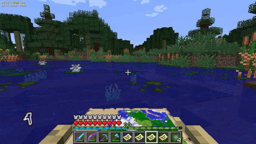
Finally I'm back on the base map, almost done. Heading south I encounter some more Fen, and then finally I reach the Wetlands north of the base.
I decide to head to my base to put up the wall map and see what the continent looks like. I boat south through the Wetlands as far as I can and then walk the rest of the way.
Home again, home again!
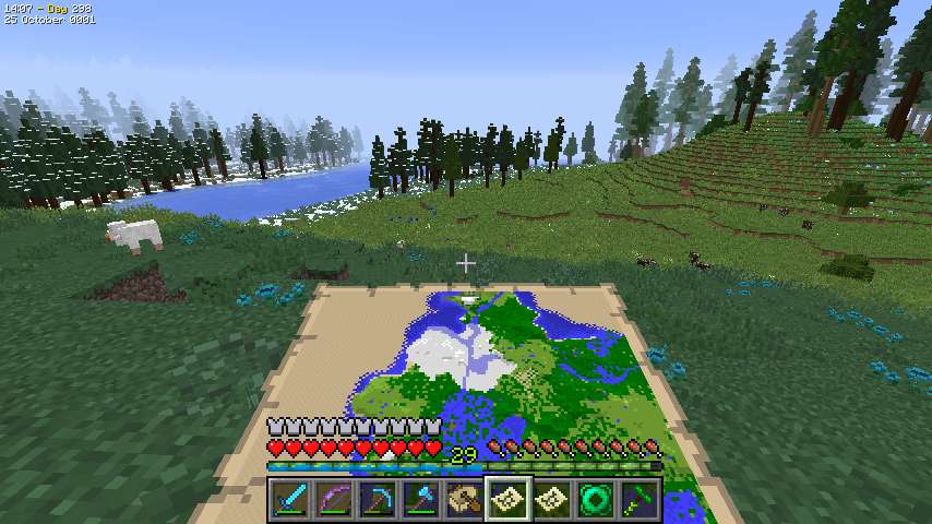
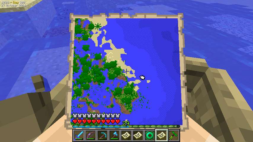
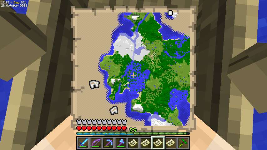
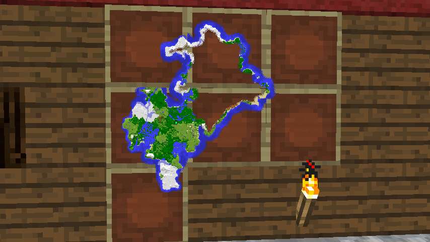
I pull out my item frames from storage and start putting up the map. I am extremely irritated to realize the last map I made was the same area as the second map I made, of the northern Moor-and-Extreme-Hllls peninsula. Since I haven't updated ExplorerCraft, i can't copy the map info and I've wasted some exploration as well as the map.
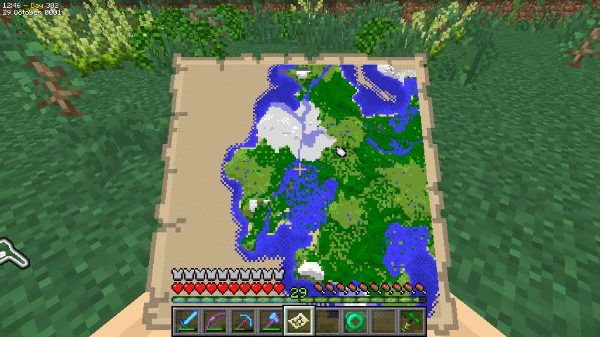
And here's the whole of what I've explored so far, less the irritatingly missing peninsula. I really like the continent, but I'm thinking I want ExplorerCraft updated before I do any more exhaustive mapping. Also, although I promised I'd completely map out all the lands I put bases on, I'm feeling the constant pressure of my schedule, and also a little burned out on writing exploration travelogue. I like writing the blow-by-blow detailed style, but after a while I just run out of things to say. How many times can you describe a Moor, or even the new Extreme Hills, without getting stale? I have a LOT more travelling to do, too.
So I decide to head out again and maybe come back later and finish this place.
Next chapter: some decoration, then on to the west.
Rollback Post to RevisionRollBack
Geographicraft (formerly Climate Control) - Control climate, ocean, and land sizes; stop chunk walls; put modded biomes into Default worlds, and more!
RTG plus - All the beautiful terrain of RTG, plus varied and beautiful trees and forests.
Just before I leave to continue west, I remember I had some ideas for decoration while walking around the continent. Walking is good for thinking.
I need some non-Spruce wood, so I head out to the Orchard to get some. I could get it from the Swampland, but those trees won't grow back right.
The Orchard is to the northwest, and sort of on the way I fill in a little bit of map I'd forgotten. I also nearly fall into a ravine in the Ice Plains.
The BoP Orchard oaks won't grow back properly either but there are some small ones that will grow back acceptably as regular oaks, so I chop them. I discover, however, that the flowering leaves drop flowering oak saplings, and I'm curious how they grow. I don't have time to plant and wait, though, so that experiment is for another day.
Back home, I start on my plan. My idea is to have a number of Bibliocraft tables as workbenches, with items from various stages of chair construction - framing boards, framing planks, seats, seat backs, and finished chairs, on the tables, which can display items. I needed the oak wood so the tables would have a different texture from the walls - otherwise they'd be too low profile.
And here's the result. WIP on the right and middle, finished cherry-framed and pink-uphostered chairs on the left. The framing boards and planks in the back right are too hard to see, but it's not a priority to fix it. The setup would actually be useful if I ever need to make a large supply of chairs, which is unlikely, but who knows.
And now it's time to go. I construct my two Waystones from my collected ender pearls and - whoops it's dark. Well, that's what beds are for -
Bah humbug. I manage to find a place I can plop a bed and sleep and snipe the creepers (there were 3 even though only 1 is visible there) from the roof in the morning.
Then I'm off. I'm going to leave from the bay to the north, so I head northeast through the Wetland. I try to boat through it some, but it's just a little too messy to pull that off. Then on to the Duski.
One last view of the Extreme Hills/Moor peninsula to the northwest as I head off. And I'm back to too-familiar views of open ocean.
X = -915,000 (wow, it's been a while since I wrote something like that)
Sunset
X = -920,000
And - it starts raining
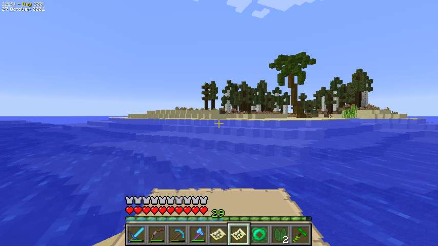
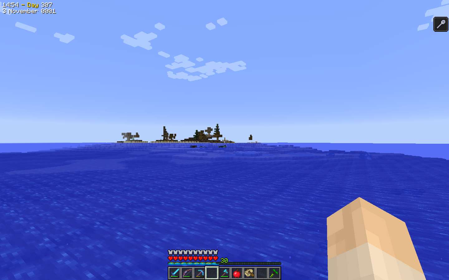
I spot land - a cold coast - past -923,000, and bump up my view distance to avoid the coast. It's small though, and I'm soon past.
X = -925,000
I get dinged by an Elder Guardian, but it doesn't matter as that will clear before dawn.
X = -930,000
Sunrise.
I'm playing classical music now to pass the time.
X = -935,000
X = -940,000
X = -945,000
Just past -945,000, the ocean floor guides me to land.
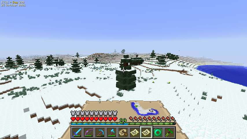
I land on a boundary between Ice Plains and Forest. Inland is a Snowy Coniferous Forest, and then an Ice Spikes - which no longer seem remarkable to me. When you do this much exploration the extraordinary becomes ordinary.
From the Ice Spikes I spot a mountain cliff. I'm not sure whether it's Ice Mountains or Extreme hills, but I'm guessing Ice Mountains since the river isn't affected. A little further on I realize there's a shrub on the very top which inclines me back to Extreme Hills but I'm still not sure. Maybe it's a mix.
I iceskate along a river for a while, then come to a Birch Forest, which has Birch Forest Hills in it, but I don't get any good pictures. Then I make another not particularly successful attempt to boat through a swamp - Fen this time - which does little but increase my BoP lilypad collection.
I reach the sea but not the west end of the continent, so I constuct the Duski and continue along the north coast, past this Savanna and stage-set Mesa Plateau.
Then there's a little strait separating the mainland on the left from an island on the right. I pass the last of that island at -947,000.
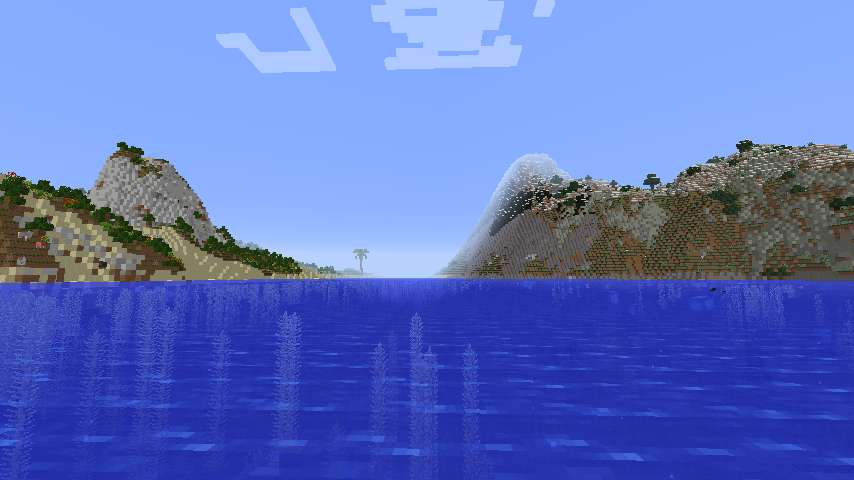
But Geographicraft has one more curveball for me with this little island well offshore. I don't think I've ever seen an offshore island this offshore.
And then it's back out to the real ocean.
Sunset.
X = -950,000
Do you smell that on the wind? Do you?
No, not the stench of decomposing squid victims of Elder Guardians. (Pew!) The other scent - the scent of a million!
Well, I admit the scent of a million blocks is less appealing than that of a million dollars. But still, take a whiff.
X = -955,000
X = -960,000
My visual glitches are back. Every time I think I've got them beat they come back. Annoying, but it doesn't seem to affect gameplay.
X = -965,000
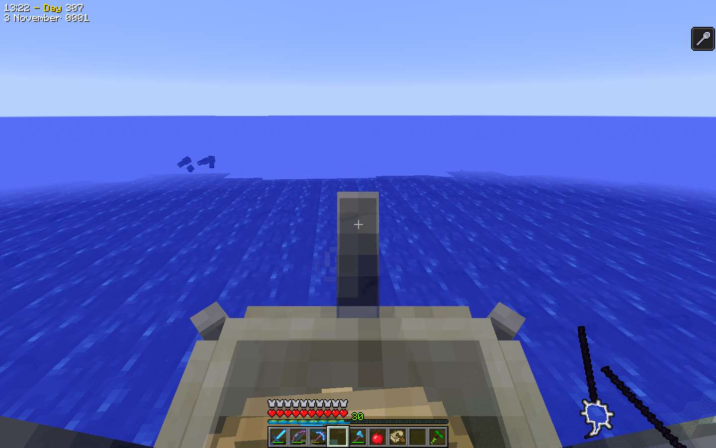
Late in the night, after X = -969,000, this BoP Coral Reef display (a shallow Ocean biome) alerts me to a nearby land.
A swampy coast. Dawn is close and I could wait a bit and land, but I don't have much reason to and the scent is beckoning. So I pass on by
X = -970,000
Right at sunrise I discover there's more to this landmass (probably). Stop, chop, and hop!
But not far as after about 1 biome of Sheild I hit the ocean again. I can see the land continues to the north, but I decide to rebuild the Duski and view by boat.
There are some interesting barrier islands and this Cold Taiga village, but nothing I feel compelled to stop for.
At X = -972,000, it's back out to sea.
X = -975,000
X = -980,000
Grrr, dinged. Now I probably won't be able to stop if I find land.
The visual problems are ridiculous, although they don't affect play - I can just keep boating on. It's related to time playing, so it's probably driven by some cache developing trouble.
X = -985,000
I spot a small swampy island at X = -987,000, but, dinged, I can't really investigate because I can't chop the Duski.
X = -990,000
The smell of a million is growing strong - even stronger than that of rotting squid guts.
Sunset.
X = -995,000
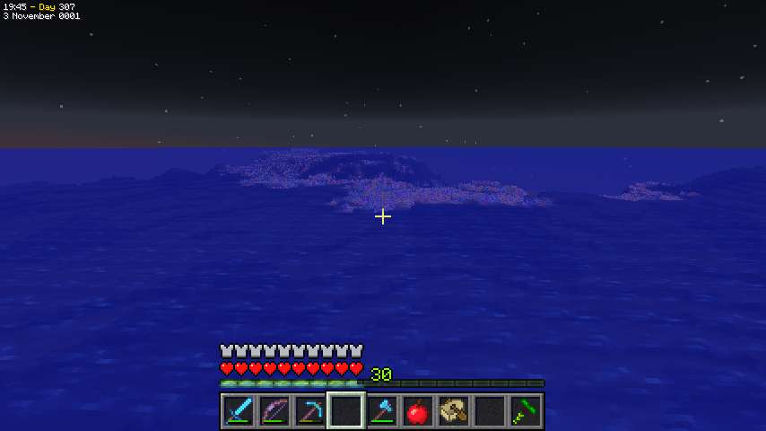
Land is nearby (and that's pretty, isn't it?)
I have F3 up and my finger on the screenshot button - but I realize the coast is coming close fast. Not good if I get creepered right after I get my million block screen shot!
I'm peering through the screen clutter trying to see exactly how close I am as I approach
X = -999,100
X = -999,200
X = -999,300
X = -999,400
X = -999,500
X = -999,600
Getting a little close for comfort
X = -999,700
X = -999,800
X = -999,900
ONE MILLION BLOCKS!
And, immediately,
HARD TO PORT!
Successfully.
And now I've earned a little celebration.
(Imagine pompous triumphant music here)
1 million down, 29 million to go.
Next Chapter: On to the "to go" part.
Rollback Post to RevisionRollBack
Geographicraft (formerly Climate Control) - Control climate, ocean, and land sizes; stop chunk walls; put modded biomes into Default worlds, and more!
RTG plus - All the beautiful terrain of RTG, plus varied and beautiful trees and forests.
(In regard to a mod that gives realistic animal genetics):
Would you really rather have bees that make diamonds and oil with magical genetic blocks?
... did I really ask that?
Sorry for the delays folks, I've had some real-life drama to deal with. I have about 2 more episodes of played material to write up and I will be continuing.
How does being dinged by a guardian affect your exploration?
When I'm dinged I can't chop the Duski to land. So I either have to abandon it (which is only a few iron, I guess, but it feels wrong) or return after a few minutes of exploration, which is usually out of the way.
Rollback Post to RevisionRollBack
Geographicraft (formerly Climate Control) - Control climate, ocean, and land sizes; stop chunk walls; put modded biomes into Default worlds, and more!
RTG plus - All the beautiful terrain of RTG, plus varied and beautiful trees and forests.
(In regard to a mod that gives realistic animal genetics):
Would you really rather have bees that make diamonds and oil with magical genetic blocks?
... did I really ask that?
Regarding your moor/river comment. How do rivers make vanilla pools worse? You mean where they connect into the side of the river? I'm honestly surprised you guys don't just mod the vanilla pool generation and placement behavior. They're always too sunken and are more like sinkholes. I think they should be placed at least one block higher or the water level of the pool generation algorithm moved up. I'm to the point where when I generate a new world I'll do so in customized mainly so I can turn water pools down to about lava pool levels.
by c0yote
I tried it with terrible results. I gave my wife my glasses for a second, a creeper showed up and now my wife is pregnant.
Stupid 3D..
-
View User Profile
-
View Posts
-
Send Message
Curse PremiumSlopes make vanilla pools worse because they end up even further down in the ground. Rivers create that problem with Moor pools because Moors are a fairly high biome and so RTG has to generate a slope down to the river.
We have written an improved version of vanilla pools but the way the game is written it's hard to change the game and requires hacking JVM code. We use our version of pools when we do the decorations but for BoP we are just using their decorations.
Geographicraft (formerly Climate Control) - Control climate, ocean, and land sizes; stop chunk walls; put modded biomes into Default worlds, and more!
RTG plus - All the beautiful terrain of RTG, plus varied and beautiful trees and forests.
The issues with vanilla pools largely stem from the fact that the game tries to generate them at a random altitude (the lake code will search downwards for solid ground if placed in the air) and the ground is rarely perfectly flat; the only restrictions on their generation are that there must be no water above their water level (within or in the walls of the cavity they generate when underground) and no air below. If they only generated on flat level ground and only at the surface there wouldn't be any issues.
My own mod's Tropical Swamp biome uses a modified version of the vanilla lake code, as well as a separate lake generator which creates 2x2 patches of water, to generate 1 block deep water lakes at the surface and most of them generate as intended; there are a few issues where the ground is more uneven but for the most part they generate level with the surrounding ground, which is very flat (minHeight and maxHeight are both 0 so there is only a slight variation from the base depth noise). I did not modify the water level used, only the code that defines their shape and how many layers deep they are (one layer of water with one layer of air carved out over it, with 1/20 of air blocks over water being lilypads):
This is one of the (few) lakes that didn't generate level with the surface on all sides, undercutting the land on the top left:
Another characteristic of these lakes is that if they generate under a tree they will fill the trunk in (or the supports of a witch hut), thus making it appear as if jungle trees grew in them, similar to swamp trees (which can grow in 1 block deep water); unlike normal world generation I generate trees before lakes (not that this matters much in vanilla due to the overlap between populated regions):
TheMasterCaver's First World - possibly the most caved-out world in Minecraft history - includes world download.
TheMasterCaver's World - my own version of Minecraft largely based on my views of how the game should have evolved since 1.6.4.
Why do I still play in 1.6.4?
-
View User Profile
-
View Posts
-
Send Message
Curse PremiumChapter 62: In Which I Discover Limitations in a Spiraling Outward Strategy, Especially When I Keep Taking River Excursions.
Exploration Limit: X = -912,000
After that I pass through some biomes near my base - the Meadow and then the Moor heading east, then north through the Moor and Savanna, then northwest through the Swampland and Wetland. I've shown all these so I'll skip pics.
The Wetland turns out to be south of the Ocean so I guess that's the limit there.
From there I continue northwest into an Orchard where the coast bends to the north.
Continuing into the Ice Plains from last chapter I find a river going north. I don't think riverboating will help with this kind of exploration but I decide to take it anyway for the fun of it. I move quickly north on the Frozen River, then still pretty fast through a Sheild except for one little spot where the river has a gravel sandbar.
I suspect the reason for that is an Extreme Hills I can glimpse through the trees. Then I go north through a Shrubland with the Extreme Hills still visible, then the Extreme Hills blocks my was and the river ends. By now I'm off the map to the north and have to make another.
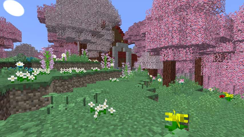
This area is a smallish penisula with a Moor and the Extreme Hills. I spend an evening ensconced on a Harvestcraft tree in the Moor. Continuing counterclockwise around my existing explorations, I turn south.
The Extreme Hills is a milder one except for that one really massive massif. I was resistant with the other RTG members pushed to revise Extreme Hills but I am really happy how it's coming out.
The coast veers to the east and I end up crossing this bay to get back to the Ice Plains. I continue south there.
My attempt to spiral outward is looking pretty ragged.
Further south, I pass through a Sheild, then more Shrubland, then Moor, then Extreme Hills. I'm getting a lot of locally repeated biomes. I'm not sure whether it's biomes getting copied during terrain manipulations or the random number generator not being quite right. It's not a bad effect, actually, because it makes terrain vary from place to place, although I do worry it reflects some programming flaws.
After all those rugged biomes I finally come to an open Plains, with a river, which I boat on in spite of the fact that river exploration obviously isn't working with this spiral out system.
It's a short river, though, and I quickly reach the sea and turn east again. Next is a Bog which I explore by boat, and then I have to turn north to pick up a spot I missed.
From this area I spot a Roofed Forest, but fortunately a smallish one so I should be able to map it by going around. On this circuit I go north of it.
Back on the Moor I spot what I think is an Extreme Hills in the distance, although when I get closer it turns out to be Chapparal. This is on the next map to the east, so I make another map. There's a village there too, which is good since I need to sleep soon, but even from here it looks to be pretty messed up. Besides the problems with the mountain, the Moor pools have intruded into the village and wrecked several of the houses. I sleep in an intact outlying farmhouse.
And it's even worse than I thought. It's been a long time since I saw a village this messed up. The Creeper outline is the resident of the Blacksmith's, of all places. After I off it, I collect two obsidian from the lava pool for Waystones.
Continuing counterclockwise, I go north through the Chaparral, then northwest through the Savanna and Wetland, finally reaching the north coast here. I take to the boat. I boat over to that strip I missed, which is Orchard, exploring that, and finding a village where I get two more obsidian. Then it's back to the boat and I loop north around the penisula on the map to the north.
After a snooze on some Extreme Hills trees, I boat across the bay again to land on the Ice Plains again.
South of the Ice Plains is yet another Moor. I deviate from my outward spiral and wriggle back and forth as I go down since the remaining land is a bit wider than my mapping path. Twice my Rod of the skies lets me hop out of a sinkhole I fall into.
This area is a penisula, and terminates with this smallish hill reaching into the sea.
Now I turn east again and boat across the bay south of the bog.
On the other side is yet another Extreme Hills with yet another cool formation. This is against the sea and I climb it partly to fill out the map and partly to see how high it is (172). Then I turn to the northeast along my previous path, reaching the Roofed Forest I saw on the last go-round.
I skirt it to the south this time and hop up to an outlying tree for the night. In the morning I have an annoyance because when I chop my bed it falls off the tree to - well I can't see where. I have wool so I can just make another, though.
I had thought I'd be able to map the Roofed Forest from the exterior but it turns out there are still a few pixels left. So I try Keybounce's suggestion and go a little bit in on top of the trees - *very* cautiously. I get my mapping done, and then hop off the trees into the adjacent Bog to the east, to continue exploring.
I boat across the Bog, and then come to a Moor. I've reached the next map to the east, and I continue eastward, preparing to wrap north around a small strip I'd explored last time.
But I soon reach the coast, and now I realize that, at the least, slavish adherence to my spiral-outward plan would create some trouble. There's an area of land to the south that would be "cut off" if I kept spiraling, so I think I'm going to change exploration strategies now.
Next Chapter: A Change of plan - and then another change of plan!
Geographicraft (formerly Climate Control) - Control climate, ocean, and land sizes; stop chunk walls; put modded biomes into Default worlds, and more!
RTG plus - All the beautiful terrain of RTG, plus varied and beautiful trees and forests.
-
View User Profile
-
View Posts
-
Send Message
Curse PremiumChapter 63: Changes and Changes and Changes

Exploration Limit: X = -912,000
So I turn back and head west again, just south of existing explorations.
I go back through the Moor, and then reach this Cold Taiga I'd seen from afar.
I follow the river to the coast, which is heading south. Apparently there's another peninsula here. I turn south, going from the Cold Taiga to an Ice Plains. Soon I have to make another map.
I go through a section of Tundra, then more Ice Plains.
This is indeed a (smallish) peninsula, and the Ice Plains continue all the way to the end. I go around the end and then head back. As with the Ice Plain/Moor section on the west side of the continent, the remaining land is wider than my map strip and I have to go back and forth to fill it out.
Night is coming and I sleep atop some of the Cold Taiga trees.
In the morning I finish the peninsula. I then boat east to pick up a little more land at the southeastern tip. As it turns out, the little bit left I can get from the boat. I then continue by boat up the eastern shore past areas I've explored or at least come close enough that I can finish from the boat.
Soon I come to something I initially expect is a strait but turns out to be a deep narrow bay.
I land and look around, but I start to feel frustrated at not having any idea how much I have left to do. I've explored the entire western end of this continent, but I have no idea how big the eastern end is. Struggling through those Extreme Hills isn't looking too convenient either. So I decide spiraling out just doesn't work, and to go to my old standby of naval circumnavigation first to see what I'm up against.
So, back to the boat, south out of the bay, and then east along the shore.
Soon I reach the place where I landed on the continent, but I continue along the shore, which turns from east to northeast here.
I pass this interesting-looking Mesa, and then another Extreme Hills. Then the coast bends back east again, and I reach a Xeric Shrubland.
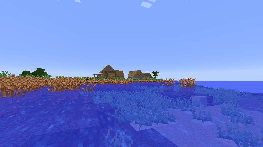
The coast finally turns north, and I spot this port village, conveniently as it's late in the afternoon. I wander around a bit chatting with the villagers and then spend the night there.
Back on the boat, I follow the coast which bends back to the east and goes on to the next map. I can tell it's only one tiny segment but I make a map anyway.
This end of the continent is very swampy.
The coast heads on to the next map, where I also realize there's just a tiny bit of land but I make the map anyway. Then it bends back to the west and I make my third map in a few minutes. It's unfortunate that the tip of the continent was right on a 4-way map intersection.
I head west on the edge of a Bog. I'm feeling kind of in a hurry so i don't detour to map the interior, although I do cut through accidentally once because sometimes it's hard to distinguish the underwater sections of Bog from the Ocean.
The Bog produces one little desert island well offshore.
Then I set off roughly WNW along the coast, passing a whole variety of biomes.
There's also a swamp village on the coast of a Marsh, but I don't stop as I already have Emeralds for 5 Waystones and Obsidian for 2. It'll be a long way before I need more.
After a while the biomes changes to Snowy. I pass a Snowy Coniferous Forest, and then a lot of Ice Plains, including this Ice Mountains range.
The coast starts to turn after I've passed almost the entire length of the map - probably over 2500 blocks. But, it's a false alarm and I continue west onto the next map, causing me to make another. I do have to land to sleep up on a tree when it gets dark. I can spent nights out on the water, of course, but I'm now to the map above the one with my base so I don't have that much coast left to explore.
When the coast finally rounds it turns out the whole last 1000 blocks has been a long narrow peninsula. I pass all the same biomes going back - the Ice Plains with big mountains, the Snowy Coniferous Forest, and the Marsh. Then there's a Fen and then some more Ice plains as the coast bends back to the south.
Finally I'm back on the base map, almost done. Heading south I encounter some more Fen, and then finally I reach the Wetlands north of the base.
I decide to head to my base to put up the wall map and see what the continent looks like. I boat south through the Wetlands as far as I can and then walk the rest of the way.
Home again, home again!
I pull out my item frames from storage and start putting up the map. I am extremely irritated to realize the last map I made was the same area as the second map I made, of the northern Moor-and-Extreme-Hllls peninsula. Since I haven't updated ExplorerCraft, i can't copy the map info and I've wasted some exploration as well as the map.
And here's the whole of what I've explored so far, less the irritatingly missing peninsula. I really like the continent, but I'm thinking I want ExplorerCraft updated before I do any more exhaustive mapping. Also, although I promised I'd completely map out all the lands I put bases on, I'm feeling the constant pressure of my schedule, and also a little burned out on writing exploration travelogue. I like writing the blow-by-blow detailed style, but after a while I just run out of things to say. How many times can you describe a Moor, or even the new Extreme Hills, without getting stale? I have a LOT more travelling to do, too.
So I decide to head out again and maybe come back later and finish this place.
Next chapter: some decoration, then on to the west.
Geographicraft (formerly Climate Control) - Control climate, ocean, and land sizes; stop chunk walls; put modded biomes into Default worlds, and more!
RTG plus - All the beautiful terrain of RTG, plus varied and beautiful trees and forests.
-
View User Profile
-
View Posts
-
Send Message
Curse PremiumChapter 64: Who Wants To Be a Millionaire?


Exploration limit: X = -912,000
Just before I leave to continue west, I remember I had some ideas for decoration while walking around the continent. Walking is good for thinking.
I need some non-Spruce wood, so I head out to the Orchard to get some. I could get it from the Swampland, but those trees won't grow back right.
The Orchard is to the northwest, and sort of on the way I fill in a little bit of map I'd forgotten. I also nearly fall into a ravine in the Ice Plains.
The BoP Orchard oaks won't grow back properly either but there are some small ones that will grow back acceptably as regular oaks, so I chop them. I discover, however, that the flowering leaves drop flowering oak saplings, and I'm curious how they grow. I don't have time to plant and wait, though, so that experiment is for another day.
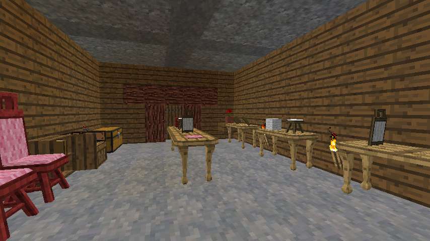
Back home, I start on my plan. My idea is to have a number of Bibliocraft tables as workbenches, with items from various stages of chair construction - framing boards, framing planks, seats, seat backs, and finished chairs, on the tables, which can display items. I needed the oak wood so the tables would have a different texture from the walls - otherwise they'd be too low profile.
And here's the result. WIP on the right and middle, finished cherry-framed and pink-uphostered chairs on the left. The framing boards and planks in the back right are too hard to see, but it's not a priority to fix it. The setup would actually be useful if I ever need to make a large supply of chairs, which is unlikely, but who knows.
And now it's time to go. I construct my two Waystones from my collected ender pearls and - whoops it's dark. Well, that's what beds are for -
Bah humbug. I manage to find a place I can plop a bed and sleep and snipe the creepers (there were 3 even though only 1 is visible there) from the roof in the morning.
Then I'm off. I'm going to leave from the bay to the north, so I head northeast through the Wetland. I try to boat through it some, but it's just a little too messy to pull that off. Then on to the Duski.
One last view of the Extreme Hills/Moor peninsula to the northwest as I head off. And I'm back to too-familiar views of open ocean.
X = -915,000 (wow, it's been a while since I wrote something like that)
Sunset
X = -920,000
And - it starts raining
I spot land - a cold coast - past -923,000, and bump up my view distance to avoid the coast. It's small though, and I'm soon past.
X = -925,000
I get dinged by an Elder Guardian, but it doesn't matter as that will clear before dawn.
X = -930,000
Sunrise.
I'm playing classical music now to pass the time.
X = -935,000
X = -940,000
X = -945,000
Just past -945,000, the ocean floor guides me to land.
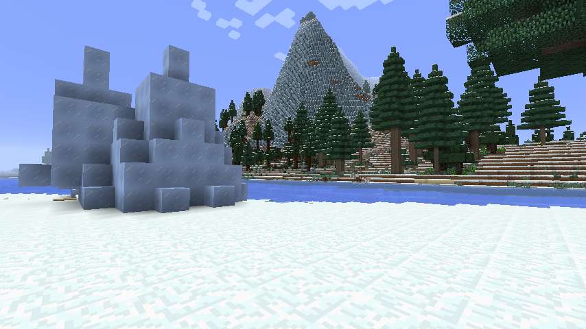
I land on a boundary between Ice Plains and Forest. Inland is a Snowy Coniferous Forest, and then an Ice Spikes - which no longer seem remarkable to me. When you do this much exploration the extraordinary becomes ordinary.
From the Ice Spikes I spot a mountain cliff. I'm not sure whether it's Ice Mountains or Extreme hills, but I'm guessing Ice Mountains since the river isn't affected. A little further on I realize there's a shrub on the very top which inclines me back to Extreme Hills but I'm still not sure. Maybe it's a mix.
I iceskate along a river for a while, then come to a Birch Forest, which has Birch Forest Hills in it, but I don't get any good pictures. Then I make another not particularly successful attempt to boat through a swamp - Fen this time - which does little but increase my BoP lilypad collection.
I reach the sea but not the west end of the continent, so I constuct the Duski and continue along the north coast, past this Savanna and stage-set Mesa Plateau.
Then there's a little strait separating the mainland on the left from an island on the right. I pass the last of that island at -947,000.
But Geographicraft has one more curveball for me with this little island well offshore. I don't think I've ever seen an offshore island this offshore.
And then it's back out to the real ocean.
Sunset.
X = -950,000
Do you smell that on the wind? Do you?
No, not the stench of decomposing squid victims of Elder Guardians. (Pew!) The other scent - the scent of a million!
Well, I admit the scent of a million blocks is less appealing than that of a million dollars. But still, take a whiff.
X = -955,000
X = -960,000
My visual glitches are back. Every time I think I've got them beat they come back. Annoying, but it doesn't seem to affect gameplay.
X = -965,000
Late in the night, after X = -969,000, this BoP Coral Reef display (a shallow Ocean biome) alerts me to a nearby land.
A swampy coast. Dawn is close and I could wait a bit and land, but I don't have much reason to and the scent is beckoning. So I pass on by
X = -970,000
Right at sunrise I discover there's more to this landmass (probably). Stop, chop, and hop!
But not far as after about 1 biome of Sheild I hit the ocean again. I can see the land continues to the north, but I decide to rebuild the Duski and view by boat.
There are some interesting barrier islands and this Cold Taiga village, but nothing I feel compelled to stop for.
At X = -972,000, it's back out to sea.
X = -975,000
X = -980,000
Grrr, dinged. Now I probably won't be able to stop if I find land.
The visual problems are ridiculous, although they don't affect play - I can just keep boating on. It's related to time playing, so it's probably driven by some cache developing trouble.
X = -985,000
I spot a small swampy island at X = -987,000, but, dinged, I can't really investigate because I can't chop the Duski.
X = -990,000
The smell of a million is growing strong - even stronger than that of rotting squid guts.
Sunset.
X = -995,000
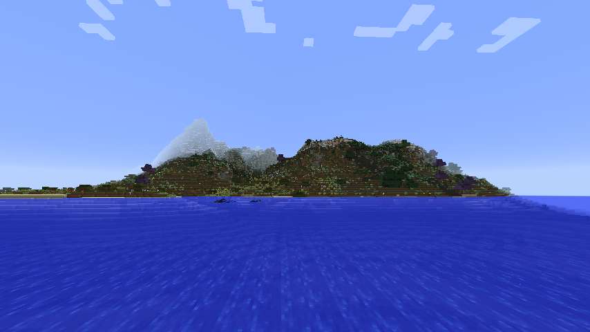
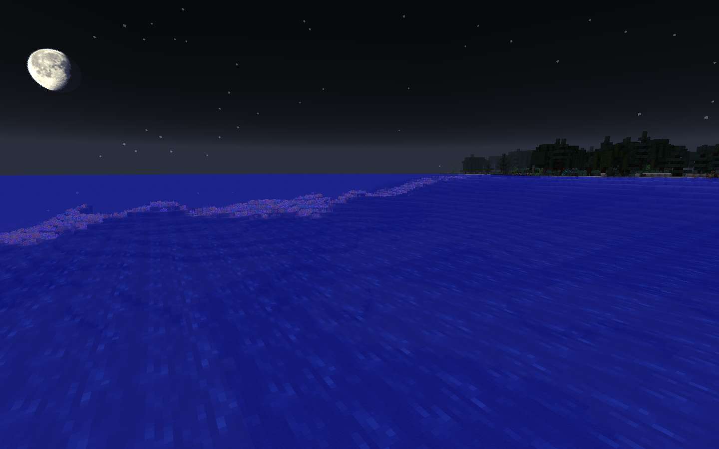
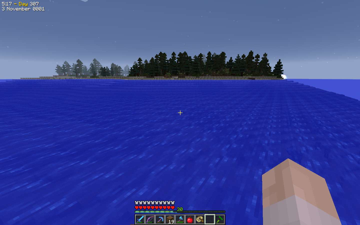
Land is nearby (and that's pretty, isn't it?)
I have F3 up and my finger on the screenshot button - but I realize the coast is coming close fast. Not good if I get creepered right after I get my million block screen shot!
I'm peering through the screen clutter trying to see exactly how close I am as I approach
X = -999,100
X = -999,200
X = -999,300
X = -999,400
X = -999,500
X = -999,600
Getting a little close for comfort
X = -999,700
X = -999,800
X = -999,900
ONE MILLION BLOCKS!
And, immediately,
HARD TO PORT!
Successfully.
And now I've earned a little celebration.
(Imagine pompous triumphant music here)
1 million down, 29 million to go.
Next Chapter: On to the "to go" part.
Geographicraft (formerly Climate Control) - Control climate, ocean, and land sizes; stop chunk walls; put modded biomes into Default worlds, and more!
RTG plus - All the beautiful terrain of RTG, plus varied and beautiful trees and forests.
-
View User Profile
-
View Posts
-
Send Message
Curse PremiumHow does being dinged by a guardian affect your exploration?
* Promoting this week: Captive Minecraft 4, Winter Realm. Aka: Vertical Vanilla Viewing. Clicky!
* My channel with Mystcraft, and general Minecraft Let's Plays: http://www.youtube.com/user/Keybounce.
* See all my video series: http://www.minecraftforum.net/forums/minecraft-editions/minecraft-editions-show-your/2865421-keybounces-list-of-creation-threads
(In regard to a mod that gives realistic animal genetics):
Would you really rather have bees that make diamonds and oil with magical genetic blocks?
... did I really ask that?
Congrats on 1 Million!! that's awesome.
Survival Minecraft, never modded (until now, TMCWv4), since alpha 1.2.1.
-
View User Profile
-
View Posts
-
Send Message
Curse PremiumSorry for the delays folks, I've had some real-life drama to deal with. I have about 2 more episodes of played material to write up and I will be continuing.
When I'm dinged I can't chop the Duski to land. So I either have to abandon it (which is only a few iron, I guess, but it feels wrong) or return after a few minutes of exploration, which is usually out of the way.
Geographicraft (formerly Climate Control) - Control climate, ocean, and land sizes; stop chunk walls; put modded biomes into Default worlds, and more!
RTG plus - All the beautiful terrain of RTG, plus varied and beautiful trees and forests.
How about carrying a milk pail and refilling off a cow during your travels?
by c0yote
I tried it with terrible results. I gave my wife my glasses for a second, a creeper showed up and now my wife is pregnant.
Stupid 3D..
-
View User Profile
-
View Posts
-
Send Message
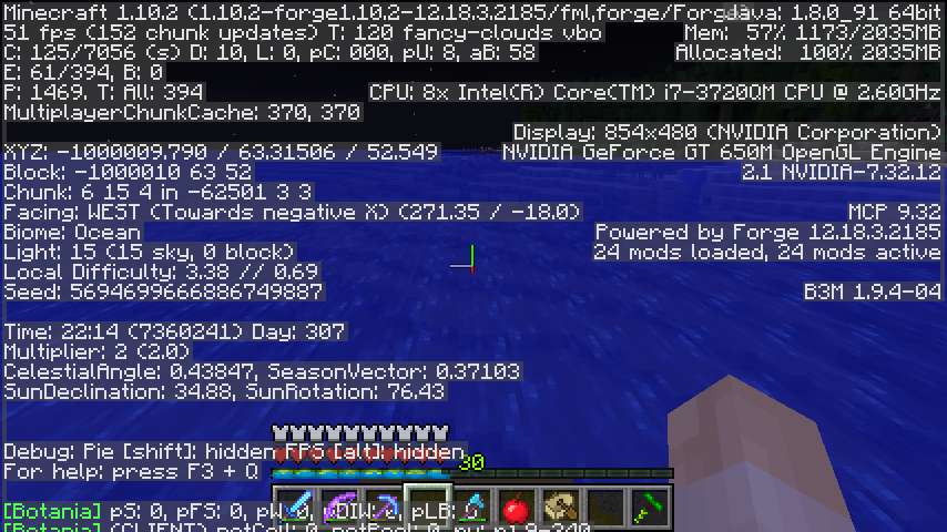
Curse Premium... so where are you now?
Have you learned anything about climate control / ... (what's it called again in 1.10? Geocraft?) or come up with new recommended settings?
* Promoting this week: Captive Minecraft 4, Winter Realm. Aka: Vertical Vanilla Viewing. Clicky!
* My channel with Mystcraft, and general Minecraft Let's Plays: http://www.youtube.com/user/Keybounce.
* See all my video series: http://www.minecraftforum.net/forums/minecraft-editions/minecraft-editions-show-your/2865421-keybounces-list-of-creation-threads
(In regard to a mod that gives realistic animal genetics):
Would you really rather have bees that make diamonds and oil with magical genetic blocks?
... did I really ask that?